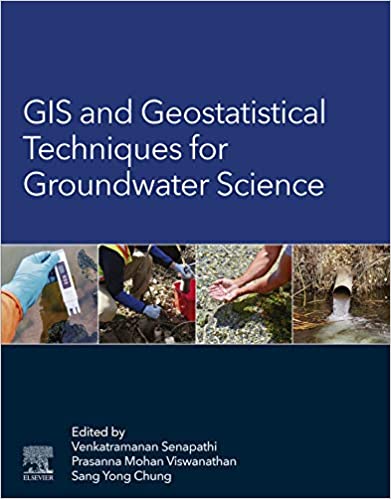
GIS and Geostatistical Techniques for Groundwater Science - Original PDF

دانلود کتاب GIS and Geostatistical Techniques for Groundwater Science - Original PDF

Author: Venkatramanan, Senapathi, Viswanathan, Prasanna Mohan, Chung, Sang Yong

0 (0)

توضیحات کتاب :

GIS and Geostatistical Techniques for Groundwater Science provides a detailed synthesis of the application of GIS and geostatistics in groundwater studies

سرچ در وردکت | سرچ در گودریدز | سرچ در اب بوکز | سرچ در آمازون | سرچ در گوگل بوک

1,262 بازدید 0 خرید

ضمانت بازگشت

ضمانت بازگشت

فایل های تست شده

فایل های تست شده

پرداخت آنلاین

پرداخت آنلاین

تضمین کیفیت

تضمین کیفیت

دانلود فوری

دانلود فوری

GIS and Geostatistical Techniques for Groundwater Science provides a detailed synthesis of the application of GIS and geostatistics in groundwater studies. As the book illustrates, GIS can be a powerful tool for developing solutions for water resource problems, assessing water quality, and managing water resources. Beginning with an introduction to the history of GIS and geostatistical techniques in groundwater studies, the book then describes various spatial techniques, including case studies for various applications, from quality assessment, to resource management. This book assembles the most up-to-date techniques in GIS and geostatistics as they relate to groundwater, one of our most important natural resources.

چکیده فارسی


GIS و تکنیک‌های زمین آماری برای علوم آب‌های زیرزمینی ترکیب دقیقی از کاربرد GIS و زمین‌آمار در مطالعات آب‌های زیرزمینی ارائه می‌کند. همانطور که کتاب نشان می دهد، GIS می تواند ابزار قدرتمندی برای توسعه راه حل هایی برای مشکلات منابع آب، ارزیابی کیفیت آب و مدیریت منابع آب باشد. این کتاب با مقدمه‌ای بر تاریخچه GIS و تکنیک‌های زمین‌آماری در مطالعات آب‌های زیرزمینی، سپس تکنیک‌های فضایی مختلف، از جمله مطالعات موردی برای کاربردهای مختلف، از ارزیابی کیفیت، تا مدیریت منابع را شرح می‌دهد. این کتاب به‌روزترین تکنیک‌ها در GIS و زمین‌آمار را در ارتباط با آب‌های زیرزمینی، یکی از مهم‌ترین منابع طبیعی ما، گردآوری می‌کند.


ادامه ...

Ebook details:
عنوان: GIS and Geostatistical Techniques for Groundwater Science
نویسنده: Venkatramanan, Senapathi, Viswanathan, Prasanna Mohan, Chung, Sang Yong
ناشر: Elsevier; 1 edition (June 15, 2019)
زبان: English
شابک: 0128154136, 978-0128154137

9780128154144 0128154144
حجم: 120 Mb
فرمت: Original PDF

ادامه ...

Front Cover; GIS and Geostatistical Techniques for Groundwater Science; Copyright; Contents; Contributors; Preface; Acknowledgments; Section A: Introduction and History of GIS and Geostatistical Techniques in Groundwater Science; Chapter 1: Fundamentals of GIS; 1.1. Introduction; 1.2. Definition of GIS; 1.3. What GIS Can Do; 1.4. Geographic Referencing Concepts; 1.5. Geographic Coordinate System; 1.6. Projected Coordinate System; 1.7. Adopted From ESRI; 1.8. Map Scale; 1.9. Creating a GIS; 1.10. GIS Data Input; 1.10.1. Vector Data Capture; 1.10.1.1. Map Projections and Scale 1.10.2. Raster Data Capture1.10.3. Attribute Data; 1.11. Data Storage and Retrieval; 1.12. Geographic Analysis; 1.13. Steps in Building a GIS; 1.14. Summary; References; Chapter 2: Merits and Demerits of GIS and Geostatistical Techniques; 2.1. Introduction; 2.2. Basic Principles of Geostatistical Methods; 2.3. Merits and Demerits of GIS; 2.3.1. Disadvantages of Geographic Information Systems; 2.3.2. Advantages of Geostatistics Techniques; 2.3.3. Disadvantages of Geostatistics techniques; 2.4. Summary; References; Chapter 3: An Introduction to Various Spatial Analysis Techniques 3.1. Introduction3.2. Types of Spatial Analysis; 3.2.1. Inverse Distance Weighting; 3.2.2. Natural Neighbor Inverse Distance Weighted; 3.2.3. Spline; 3.2.4. Spline Interpolations; 3.2.5. Kriging; 3.3. Kriging Types; 3.3.1. Ordinary Kriging; 3.3.2. Simple Kriging; 3.3.3. Universal Kriging; 3.3.4. Indicator Kriging; 3.3.5. Probability Kriging; 3.3.6. Disjunctive Kriging; 3.3.7. Topo Grid/Topo to Raster; 3.4. Summary; References; Section B: Types of Geospatial and Geostatistical Techniques Chapter 4: Supplement of Missing Data in Groundwater-Level Variations of Peak Type Using Geostatistical Methods4.1. Introduction; 4.2. Groundwater Level Data With a Peak Type Variation; 4.3. Geostatistical Methods; 4.3.1. Kriging; 4.3.2. Variogram; 4.3.3. Conditional Simulation; 4.4. Comparison of Interpolation Capability; 4.4.1. Statistical Validation Test; 4.4.2. Interpolation of Artificial Missing Data; 4.5. Interpolation of Actual Missing Data; 4.5.1. Application of Kriging; 4.5.2. Application of Conditional Simulation; 4.5.3. Cross Validation Test; 4.6. Conclusions; References Chapter 5: A Comparative Study of Spatial Interpolation Technique (IDW and Kriging) for Determining Groundwater Quality5.1. Introduction; 5.1.1. Nongeostatistical Interpolation Methods; 5.1.2. Geostatistical Interpolation Methods; 5.1.2.1. Semivariogram; 5.1.2.2. Kriging; 5.1.3. Use of Geostatistics for the Study of Groundwater Quality; 5.2. Geographic Setup and Hydrogeological Characteristics; 5.3. Data and Methods Used; 5.3.1. Exploring the Dataset; 5.3.2. Interpolation Methods; 5.3.3. Semivariogram Modeling; 5.3.4. Cross-Validation; 5.3.5. Prediction Map; 5.4. Results and Discussion

ادامه ...
برای ارسال نظر لطفا وارد شوید یا ثبت نام کنید
ادامه ...
پشتیبانی محصول

۱- در صورت داشتن هرگونه مشکلی در پرداخت، لطفا با پشتیبانی تلگرام در ارتباط باشید.

۲- برای خرید محصولات لطفا به شماره محصول و عنوان دقت کنید.

۳- شما می توانید فایلها را روی نرم افزارهای مختلف اجرا کنید(هیچگونه کد یا قفلی روی فایلها وجود ندارد).

۴- بعد از خرید، محصول مورد نظر از صفحه محصول قابل دانلود خواهد بود همچنین به ایمیل شما ارسال می شود.

۵- در صورت وجود هر مشکلی در فرایند خرید با تماس بگیرید.

محصولات مشابه