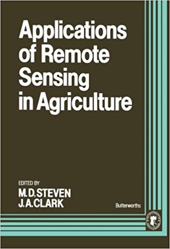
Applications of Remote Sensing in Agriculture

دانلود کتاب Applications of Remote Sensing in Agriculture

Author: J. A. Clark, M.D. Steven

0 (0)

توضیحات کتاب :

Agricultural remote sensing has an enormous potential impact on agribusiness and the international commodity trade through the development of systems to monitor crops and yields on the national and international scale

سرچ در وردکت | سرچ در گودریدز | سرچ در اب بوکز | سرچ در آمازون | سرچ در گوگل بوک

985 بازدید 0 خرید

ضمانت بازگشت

ضمانت بازگشت

فایل های تست شده

فایل های تست شده

پرداخت آنلاین

پرداخت آنلاین

تضمین کیفیت

تضمین کیفیت

دانلود فوری

دانلود فوری

Agricultural remote sensing has an enormous potential impact on agribusiness and the international commodity trade through the development of systems to monitor crops and yields on the national and international scale. This volume reviews the achievements of remote sensing in agriculture, establishes the current state-of-the-art and looks at future developments. The following themes are addressed - opportunities for remote sensing, principles of remote sensing as applied to agriculture, including logistic considerations and fundamental spectral characteristics of vegetation, the estimation of biomass and productivity, effects of stress and its detection, discrimination and monitoring and new techniques in applying remote sensing.

چکیده فارسی

سنجش از دور کشاورزی از طریق توسعه سیستم‌هایی برای نظارت بر محصولات و عملکرد در مقیاس ملی و بین‌المللی، تأثیر بالقوه زیادی بر تجارت کشاورزی و تجارت بین‌المللی کالا دارد. این جلد دستاوردهای سنجش از دور در کشاورزی را بررسی می‌کند، وضعیت فعلی هنر را ایجاد می‌کند و به تحولات آینده نگاه می‌کند. موضوعات زیر مورد بررسی قرار می گیرند - فرصت های سنجش از دور، اصول سنجش از دور که در کشاورزی اعمال می شود، از جمله ملاحظات لجستیک و ویژگی های طیفی اساسی پوشش گیاهی، تخمین زیست توده و بهره وری، اثرات استرس و تشخیص آن، تبعیض و نظارت و تکنیک های جدید. در استفاده از سنجش از راه دور.

ادامه ...

Ebook details:
عنوان: Applications of Remote Sensing in Agriculture
نویسنده: J. A. Clark, M.D. Steven
ناشر: Butterworth-Heinemann (January 1, 1991)
زبان: English
شابک: 0408047674, 978-0408047678
حجم: 47 Mb
فرمت: True Pdf

ادامه ...

Front Cover; Applications of Remote Sensing in Agriculture; Copyright Page; Table of Contents; PREFACE; ACKNOWLEDGEMENTS; PART I: PRINCIPLES; CHAPTER 1. SENSORS, PLATFORMS AND APPLICATIONS; ACQUIRING AND MANAGING REMOTELY SENSED DATA; Introduction; Some general features of agricultural applications; Trends in technological development; Information needs for agricultural applications; The need for all-weather systems; The inescapable place of sampling: the agricultural case; Applications at various scales; Earth observation and holistic information systems -- the future. Geographical information systems at the local and national scalesFuture systems; References; CHAPTER 2. OPTICAL PROPERTIES OF VEGETATION CANOPIES; Introduction; Optical properties of the components of a vegetation canopy; Reflectance spectra of plant canopies; Effects of external factors on the reflectance of plant canopies; Influence of internal factors; Conclusions; References; CHAPTER 3. FACTORS AFFECTING THE RADIATIVE TEMPERATURE OF A VEGETATIVE CANOPY; Introduction; External environmental factors; Plant factors; Other factors; Conclusions; References; PART II. CLIMATE AND SOIL. CHAPTER 4. DISCRIMINATION AND MONITORING OF SOILSIntroduction; Remote sensing and soil mapping; Soil map scale and remote sensing; Photo/image type for interpretive studies; Digital analysis of images for discriminating soils; Remote sensing for recording the interactions of crop growth with soils and weather; Remote sensing of soil moisture; Remote sensing and soil degradation; Conclusions; References; CHAPTER 5. ESTIMATION OF RAINFALL USING GEOSTATIONARY SATELLITE DATA; Introduction; Rainfall estimates from cold cloud statistics; Calibration and validation; Selected results. Utility of estimatesConclusions; Acknowledgements; References; CHAPTER 6. APPLICATION OF REMOTE SENSING AND GEOGRAPHICAL INFORMATION SYSTEMS IN WATER MANAGEMENT; Introduction; Two methods to determine actual crop transpiration; Integration of remotely sensed imagery and SWATRE simulations in a geographical information system; Experience with transpiration mapping from remotely sensed imagery in agricultural water management; Conclusions and discussion; References; PART III: LAND CLASSIFICATION AND CROP INVENTORIES; CHAPTER 7. THEORETICAL PROBLEMS IN IMAGE CLASSIFICATION; Introduction. Image classification: The per-pixel approachDifficulties with the per-pixel approach; Conclusions; References; CHAPTER 8. ESTIMATING PRODUCTION OF WINTER WHEAT BY REMOTE SENSING AND UNIFIED GROUND NETWORK. I. SYSTEM VERIFICATION; Introduction; Results; System for collecting, transferring and storing crop information; Estimation of growing area of winter wheat; Estimation of yield and total output; Dynamic monitoring of crop growth and development; Support research techniques and methods; Conclusion; Acknowledgement; References.

ادامه ...
برای ارسال نظر لطفا وارد شوید یا ثبت نام کنید
ادامه ...
پشتیبانی محصول

۱- در صورت داشتن هرگونه مشکلی در پرداخت، لطفا با پشتیبانی تلگرام در ارتباط باشید.

۲- برای خرید محصولات لطفا به شماره محصول و عنوان دقت کنید.

۳- شما می توانید فایلها را روی نرم افزارهای مختلف اجرا کنید(هیچگونه کد یا قفلی روی فایلها وجود ندارد).

۴- بعد از خرید، محصول مورد نظر از صفحه محصول قابل دانلود خواهد بود همچنین به ایمیل شما ارسال می شود.

۵- در صورت وجود هر مشکلی در فرایند خرید با تماس بگیرید.