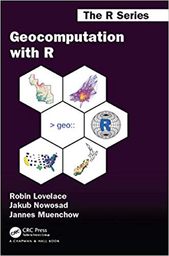
Geocomputation with R is for people who want to analyze, visualize and model geographic data with open source software. It is based on R, a statistical programming language that has powerful data processing, visualization, and geospatial capabilities. The book equips you with the knowledge and skills to tackle a wide range of issues manifested in geographic data, including those with scientific, societal, and environmental implications. This book will interest people from many backgrounds, especially Geographic Information Systems (GIS) users interested in applying their domain-specific knowledge in a powerful open source language for data science, and R users interested in extending their skills to handle spatial data.
The book is divided into three parts: (I) Foundations, aimed at getting you up-to-speed with geographic data in R, (II) extensions, which covers advanced techniques, and (III) applications to real-world problems. The chapters cover progressively more advanced topics, with early chapters providing strong foundations on which the later chapters build. Part I describes the nature of spatial datasets in R and methods for manipulating them. It also covers geographic data import/export and transforming coordinate reference systems. Part II represents methods that build on these foundations. It covers advanced map making (including web mapping), "bridges" to GIS, sharing reproducible code, and how to do cross-validation in the presence of spatial autocorrelation. Part III applies the knowledge gained to tackle real-world problems, including representing and modeling transport systems, finding optimal locations for stores or services, and ecological modeling. Exercises at the end of each chapter give you the skills needed to tackle a range of geospatial problems. Solutions for each chapter and supplementary materials providing extended examples are available at https://geocompr.github.io/geocompkg/articles/.
Dr. Robin Lovelace is a University Academic Fellow at the University of Leeds, where he has taught R for geographic research over many years, with a focus on transport systems. Dr. Jakub Nowosad is an Assistant Professor in the Department of Geoinformation at the Adam Mickiewicz University in Poznan, where his focus is on the analysis of large datasets to understand environmental processes. Dr. Jannes Muenchow is a Postdoctoral Researcher in the GIScience Department at the University of Jena, where he develops and teaches a range of geographic methods, with a focus on ecological modeling, statistical geocomputing, and predictive mapping. All three are active developers and work on a number of R packages, including stplanr, sabre, and RQGIS.
چکیده فارسی
محاسبات جغرافیایی با R برای افرادی است که می خواهند داده های جغرافیایی را با نرم افزار منبع باز تجزیه و تحلیل، تجسم و مدل سازی کنند. این زبان مبتنی بر R است، یک زبان برنامه نویسی آماری که دارای پردازش داده، تجسم و قابلیت های مکانی است. این کتاب شما را با دانش و مهارت های مقابله با طیف گسترده ای از مسائل که در داده های جغرافیایی آشکار می شود، از جمله مواردی که پیامدهای علمی، اجتماعی و زیست محیطی دارند، مجهز می کند. این کتاب افراد با زمینههای مختلف، بهویژه کاربران سیستمهای اطلاعات جغرافیایی (GIS) را که علاقهمند به استفاده از دانش خاص دامنه خود در یک زبان منبع باز قدرتمند برای علم داده هستند، و کاربران R علاقهمند به گسترش مهارتهای خود برای مدیریت دادههای مکانی، مورد توجه قرار میدهد. p>
این کتاب به سه بخش تقسیم میشود: (I) مبانی، با هدف بهروزرسانی شما با دادههای جغرافیایی در برنامههای افزودنی R، (II) که تکنیکهای پیشرفته را پوشش میدهد، و (III) برنامههای کاربردی در دنیای واقعی چالش ها و مسائل. فصلها به تدریج موضوعات پیشرفتهتری را پوشش میدهند و فصلهای اولیه پایههای قویتری را ارائه میکنند که فصلهای بعدی بر آن بنا میشوند. قسمت اول ماهیت مجموعه داده های فضایی در R و روش های دستکاری آنها را توضیح می دهد. همچنین واردات/صادرات داده های جغرافیایی و سیستم های مرجع مختصات تبدیل را پوشش می دهد. بخش دوم روش هایی را نشان می دهد که بر این پایه ها بنا می شوند. این شامل ساخت نقشه پیشرفته (از جمله نقشه برداری وب)، "پل" به GIS، به اشتراک گذاری کد قابل تکرار، و نحوه انجام اعتبار سنجی متقابل در حضور خودهمبستگی مکانی است. بخش سوم دانش بهدستآمده را برای مقابله با مشکلات دنیای واقعی، از جمله نمایش و مدلسازی سیستمهای حملونقل، یافتن مکانهای بهینه برای فروشگاهها یا خدمات، و مدلسازی زیستمحیطی به کار میگیرد. تمرینات در پایان هر فصل به شما مهارت های مورد نیاز برای مقابله با طیف وسیعی از مشکلات جغرافیایی را می دهد. راهحلهای هر فصل و مطالب تکمیلی ارائهکننده مثالهای گسترده در https://geocompr.github.io/geocompkg/articles/ موجود است.
دکتر رابین لاولیس یک عضو دانشگاهی در دانشگاه لیدز است که در آن سالها تحقیقات جغرافیایی را با تمرکز بر سیستمهای حملونقل در آنجا تدریس کرده است. دکتر جاکوب نووساداستیار گروه اطلاعات جغرافیایی در دانشگاه آدام میکیویچ در پوزنان، جایی که تمرکز او بر تجزیه و تحلیل مجموعه داده های بزرگ برای درک فرآیندهای محیطی است. دکتر Jannes Muenchowپژوهشگر فوق دکترا در بخش GIScience در دانشگاه ینا است که در آنجا طیف وسیعی از روشهای جغرافیایی را با تمرکز بر مدلسازی اکولوژیکی، ژئومحاسبات آماری و نقشهبرداری پیشبینی توسعه داده و آموزش میدهد. هر سه توسعه دهندگان فعال هستند و روی تعدادی بسته R کار می کنند، از جمله stplanr، sabre، و RQGIS.
ادامه ...
بستن ...
Ebook details:
عنوان: Geocomputation with R (Chapman & Hall/CRC The R Series) (9781138304512) Robin Lovelace, Jakub Nowosad, Jannes Muenchow
نویسنده: Books
ناشر: Chapman and Hall/CRC; 1 edition (March 25, 2019)
زبان: English
شابک: 1138304514, 978-1138304512
حجم: 48 Mb
فرمت: True Pdf
ادامه ...
بستن ...



![[Soultion Manual] Statistics for Management and Economics (11th Edition) - Word [Soultion Manual] Statistics for Management and Economics (11th Edition) - Word](https://dl.libsan.ir/images/1/12/61JGRNKwfUL._SY466__66fd1fc169714.jpg)

